Sun, Aug 2 Today

26° 15°
Wind 11 km/h
Precipitation 0 mm
Snowfall 0 cm
December 13, 2025
April 12, 2026
47.50€
Weather
26° 15°
25° 15°
23° 15°
21° 13°
18° 13°
17° 11°
17° 9°
Source: Open-Meteo
🏔️ History
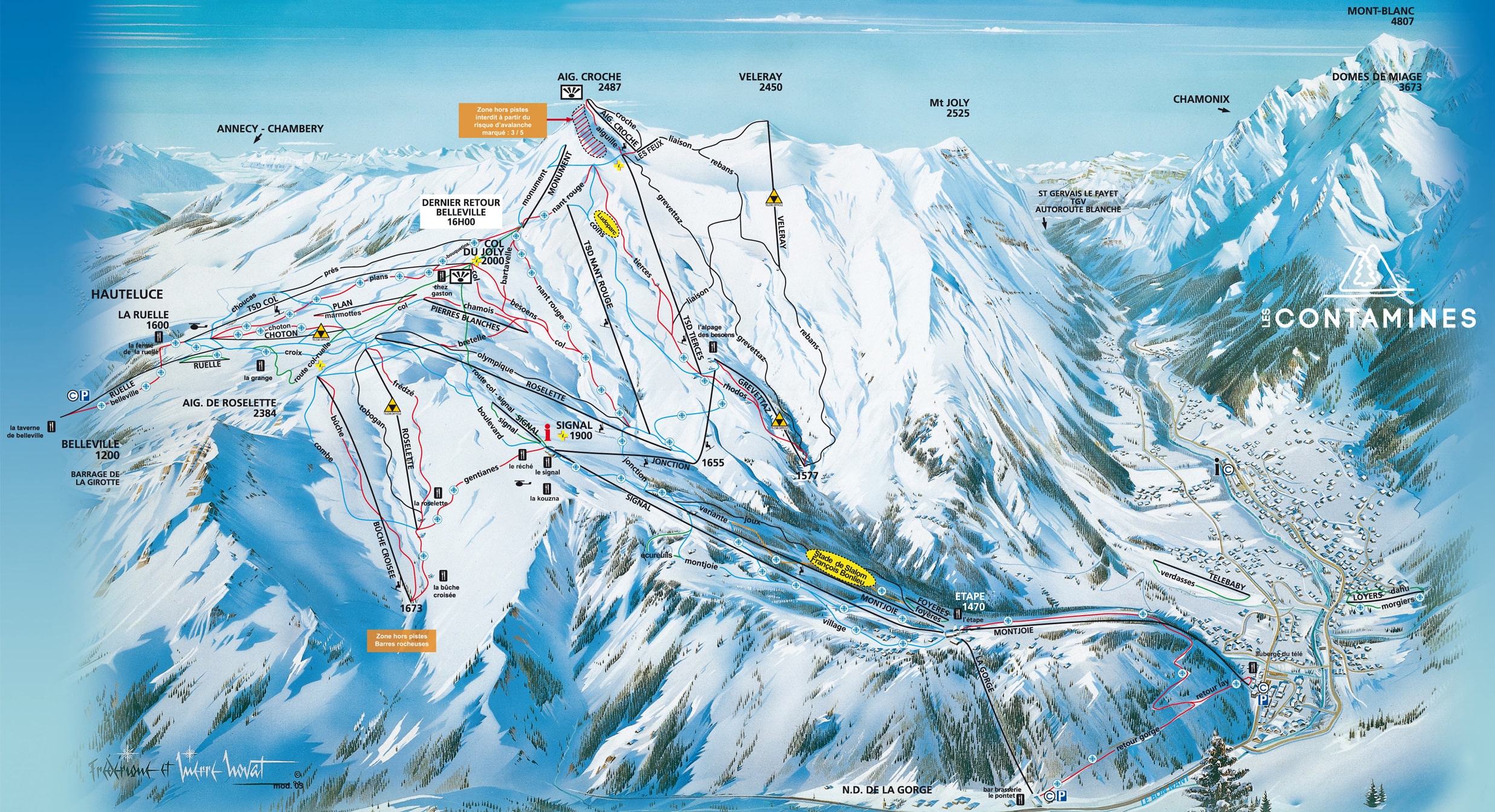
Nestled on the western edge of the Mont Blanc massif, Les Contamines-Montjoie is a resort with a strong Alpine identity that forms part of the vast Evasion Mont-Blanc area. It maintains a pure, unspoiled village atmosphere far removed from massive real estate speculation, and is historically revered by skiers seeking wild nature, with terrain ranging from gentle meadows to the impressive Tré-la-Tête glaciers.
☀️ Best days
Clear days following northwest storms. The resort enjoys a particular microclimate thanks to its proximity to Mont Blanc, often guaranteeing excellent accumulations of cold, dry snow. Because its highest slopes reach nearly 2,500 m on shaded aspects, powder preservation is spectacular.
🚫 Days to avoid
Periods of intense cold in January on cloudy days. A large part of the domain, especially the higher areas towards Col du Joly and Aiguille Croche, are exposed and shaded for much of the day, making them freezing and somewhat inhospitable if the sun isn't out.
💡 Community tip
Don't just stick to the marked runs. The sidecountry edges toward the Hauteluce sector offer highly accessible and fun "freeride" zones (always with caution). For unforgettable 360-degree views, including Mont Blanc, taking the lift up to l'Aiguille Croche is an absolute must.
🚗 Main access: Take the A40 motorway (the "Autoroute Blanche") and exit at junction 21 (Passy / Saint-Gervais). Follow the D1205 towards Saint-Gervais, then take the D902 mountain road which leads directly up into the Val Montjoie valley to Les Contamines-Montjoie.
⚠️ Chains and traffic: The road from Saint-Gervais climbs steadily but is well maintained. Note that during winter (Nov 1st - Mar 31st), it is legally required to have winter tires or snow chains in your vehicle.
💡 Free Shuttles (Facilibus): During winter, the village operates an excellent free shuttle bus service ("Facilibus") linking all neighborhoods, the center, and the Nordic domain to the gondola bases (La Gorge and Le Signal). Leave your car parked and use the bus.


